home | publications | my photos | historical pictures | travel snap shots | monuments | 19th century sources | research tools | links | contact
Hogeac’vank (St. Mary Monastery, Der Meryem), Gürpınar, Van
all pictures © Jelle Verheij, 2011
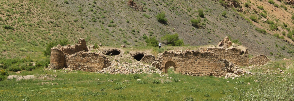
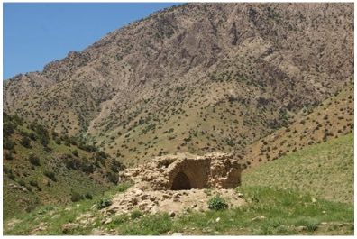
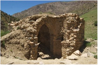
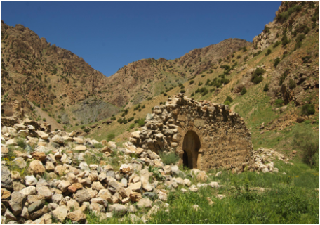
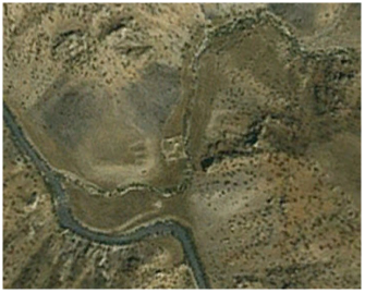
On a secluded spot close to the shore of the Çatak river, currently in the district of Gürpınar (Van province) lies the Armenian monastic complex of Hogeacvank, locally known as the Monastery of St. Mary ( Der Meryem). The monastery was actually a fortress like structure, nearly rectangular and occupying some 2.000m2. Outside the walls there is a second church.
The monastery has reputedly apostolic origins, but J.P Thierry believes that this story was invented, probably in the 11th century. The main church seems to date from the same time. In this period already, the monastery was an important one. One abbot of Hogeacvank was candidate to become catholicos of the Armenian church.
As far as can be judged from its manuscripts that survived, Hogeacvank never was such an important centre of learning as some of the other monasteries in the Van region, but the scriptorium of the monastery was still active in the 17th century.
Despite being situated in an area that effectively remained outside government control till until the end of the 19th century, throughout that century the monastery remained an important place of pilgrimage, attracting Armenians from far away, particularly on religious holidays. It had extensive properties in the current districts of Çatak, Gürpınar and Edremit.
Hogeavank, like so many Armenian monastic establishments and churches in the region was plundered by Kurds during the massacres of 1895, but monks remained there until WWI. The church was for the last time repaired in 1904.
Due to its isolated position, away from the main routes, in the 19th century few foreign travellers visited the monastery. The German geographer Wünsch, in search of the sources of the Tigris (the Çatak Su is was one of the tributaries of the Tigris) visited Hogeacvank in the 1880s.
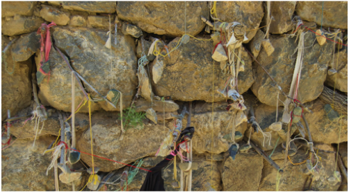
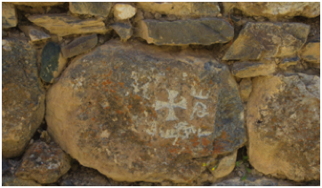
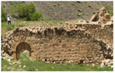
Nowadays, the monastery is still not easily accessible. To reach it, one must follow a footpath along the Çatak River. Far away from inhabited places, it is at the mercy of treasure hunters, who caused heavy damage to all parts of the complex. Interesting, among the Kurdish villagers of the vicinity the monastery is still revered as well. Particularly women wishing to become pregnant leave pieces of cloth at the chapel outside the walls (fig.6)
source: J.M. Thierry, Monasterères Arméniens du Vaspurakan I, in: Révue des études arméniennes, nouvelle série, 4 (1967) pp. 168-178
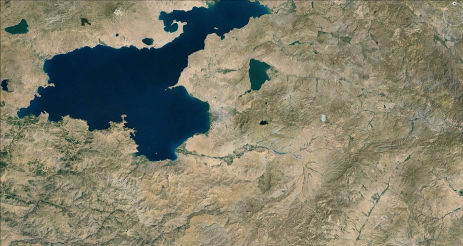
map
Google Earth® map showing the location of Hogeacvank
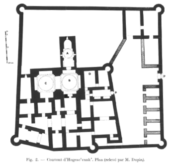
(1) Plan of the Monastery, drawn by J.M. Thierry
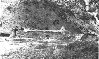
(2) Hogeacvank in the 1960s as pictured by Thierry
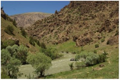
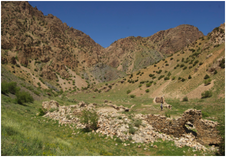
(3) On the way to Hogeacvank, along the Çatak river
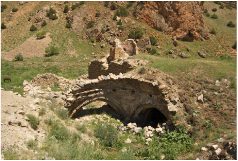
(4-6) The church outside the walls
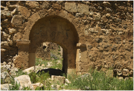
(7-8) South side of the wall + main entrance
(9) View of the complex from the West
(10) Roof of the church
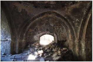
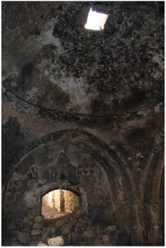
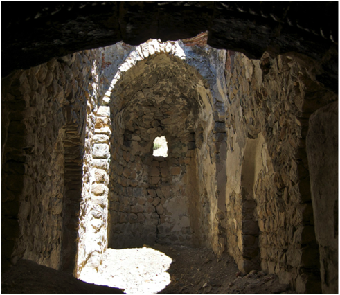
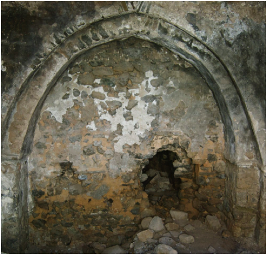
(11-15) Interior of the church
15
13
12
11
14
9
10
8
7
6
5
4
3
➜
St. Mary Monastery
➜