home | publications | my photos | historical pictures | travel snap shots | monuments | 19th century sources | research tools | links | contact
Notice
This map is reproduced under the assumption that it is not copyrighted. If you feel that your copyright is infringed, it will be withdrawn from this site upon complaint
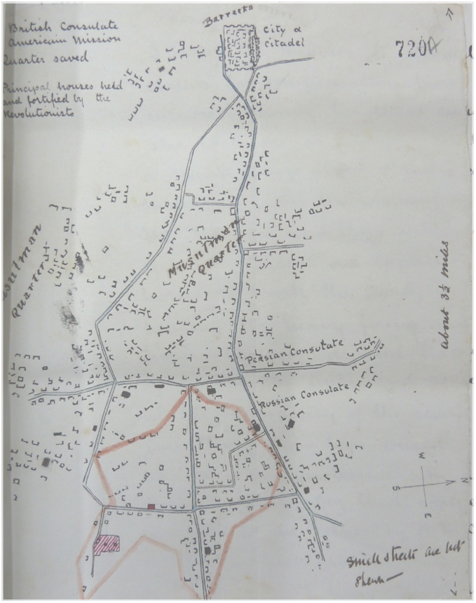
Sketch map of part of Van city during the Armenian-Ottoman conflict of 1896
Sketch map of Van showing neighborhoods, foreign consulates and “principal houses held and fortified” by Armenian revolutionaries during the 1896 Revolt. Drawn by the British Vice-Consul in Van, Major Williams (archival document, UK National Archives)
The north is to the right